

Hurricane Dorian: US braced for ‘life-threatening’ storm surge
Media playback is unsupported on your device Hurricane Dorian is expected to bring a "life-threaten..
Media playback is unsupported on your device
Hurricane Dorian is expected to bring a "life-threatening storm surge" up the US east coast after causing widespread destruction in the Bahamas.
Residents from Florida all the way up to Virginia are warned to listen to emergency advice as the category two hurricane slowly moves north.
The storm has weakened after killing at least 20 people in the Bahamas.
Bahamas PM Hubert Minnis called it "one of the greatest national crises in our country's history".
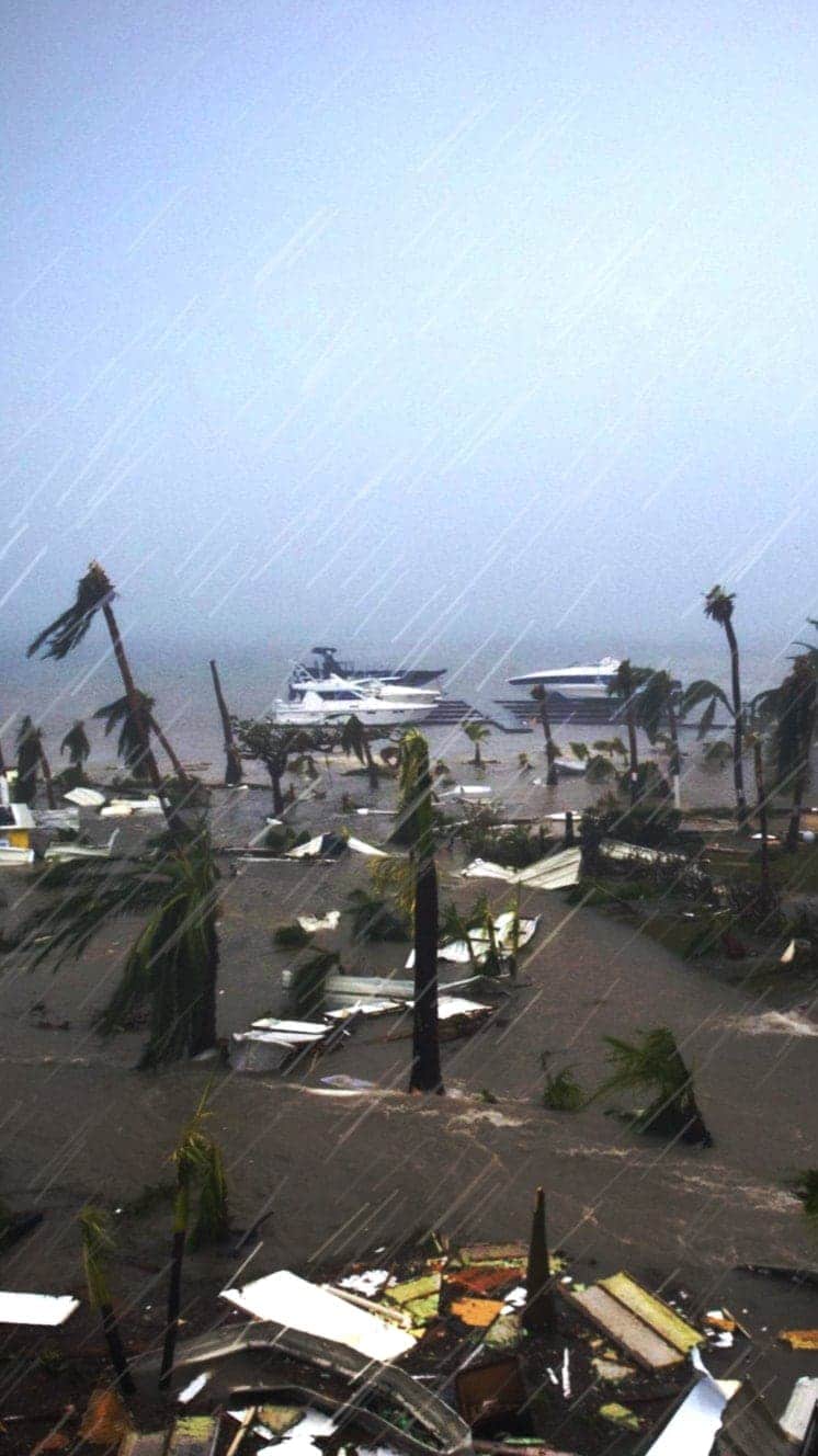
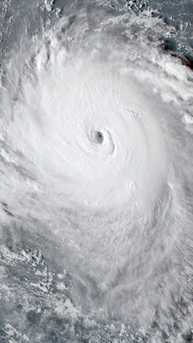
On 1 September Dorian hit the country with winds of up to 185 mph (298 km/h) – equalling the highest ever recorded at landfall. It battered the Abaco Islands and Grand Bahama, in the north of the archipelago, for two days.
Although the storm weakened after moving north late on Tuesday, it has also grown in area.
What's the latest on the storm?
Dorian is currently east of the state of Georgia moving north at about seven miles per hour (12km/h), with maximum sustained winds of 115mph (185km/h). It is expected to turn north on Wednesday night.
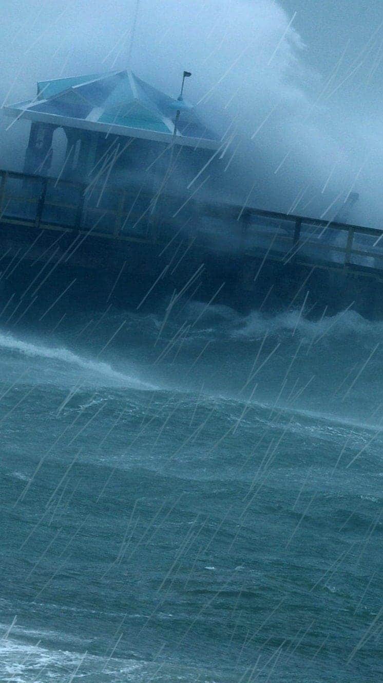
The US National Hurricane Center (NHC) warned of a "life-threatening storm surge and dangerous winds" for the coasts of Florida, Georgia, North and South Carolina, and Virginia, all the way up to Chesapeake Bay.
Graphics showed waters could rise up to 8 feet (2.4m) above ground level on the South Carolina coast, and up to 15 inches of rain could fall in the coming days.
"Time to get out is running out", the state's governor Henry McMaster told reporters.
"Water levels could rise well in advance of the arrival of strong winds," the NHC said, adding these storm surges are expected "regardless of the exact track of Dorian's center".
Flash flooding is also expected in Georgia and in the Carolinas.
US President Donald Trump earlier held up a map incorrectly suggesting Dorian could hit Alabama. Some observers said it looked as though a line around the state was drawn with a felt pen.
The president has since said he did not know why the chart showed this.
Presidential candidate Marianne Williamson meanwhile earlier suggested on Twitter that prayer could drive the storm away. She defended her now-deleted tweet, claiming that those praying should not be treated with "mockery or condescension".
What happened in the Bahamas?
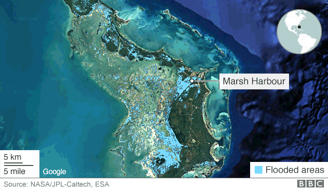
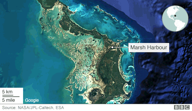
Although Grand Bahama suffered severe damage and floods, the northern Abaco Islands were hardest hit. Footage taken from the air showed vast swathes of destruction. Homes, roads and businesses have been torn apart, and high waters remain.
Health Minister Duane Sands told the Washington Post 17 had died in the Abaco Islands and three on Grand Bahama. These figures are reportedly expected to rise as rescuers search through the devastated country.
"There's nothing left in most of Marsh Harbour," said Alicia Cook, who evacuated from the area in the Abaco Islands. "People are starting to panic: pillaging, looting."
Bob Cornea also spoke to the BBC in the capital Nassau after being evacuated from Marsh Harbour. He said he and his wife took shelter on the second storey of their son's house.
"Water was up to my neck. It stayed like that for two or three hours… My son… he got us out and we got over to safety.
"We've been through all kinds of hurricanes, all kinds of storms: never anything that bad. I mean, it was like we were standing in the middle of the ocean. That's what it looked like. Waves, the water just crashing in over us. Horrifying. Absolutely horrifying."
Interactive See extent of flooding in Abaco Islands caused by Hurricane Dorian
After Dorian
Before Dorian
The International Red Cross fears 45% of homes on Grand Bahama and the Abacos – some 13,000 properties – have been severely damaged or destroyed.
Some 70,000 people are in "immediate need" of aid, UN officials said.
Is climate change making hurricanes worse?
Scientists cannot say whether climate change is increasing the number of hurricanes, but the ones that do happen are likely to be more powerful and more destructive because of our warming climate, says BBC Weather's Tomasz Schafernaker.
Here's why:
- An increase in sea surface temperatures strengthens the wind speeds within storms and also raises the amount of precipitation a hurricane will dump
- Sea levels are expected to increase by one to four feet over the next century, bringing the potential of far worse damage from sea surges and coastal flooding during storms
Media playback is unsupported on your device
Use our guide to see how these deadly storms form, their devastating effects and how they are measured:
Hurricanes
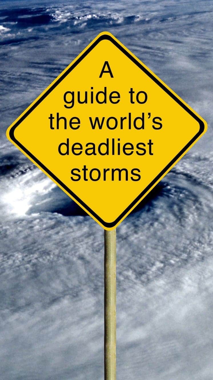
A guide to the world's deadliest storms
Hurricanes are violent storms that can bring devastation to coastal areas, threatening lives, homes and businesses.

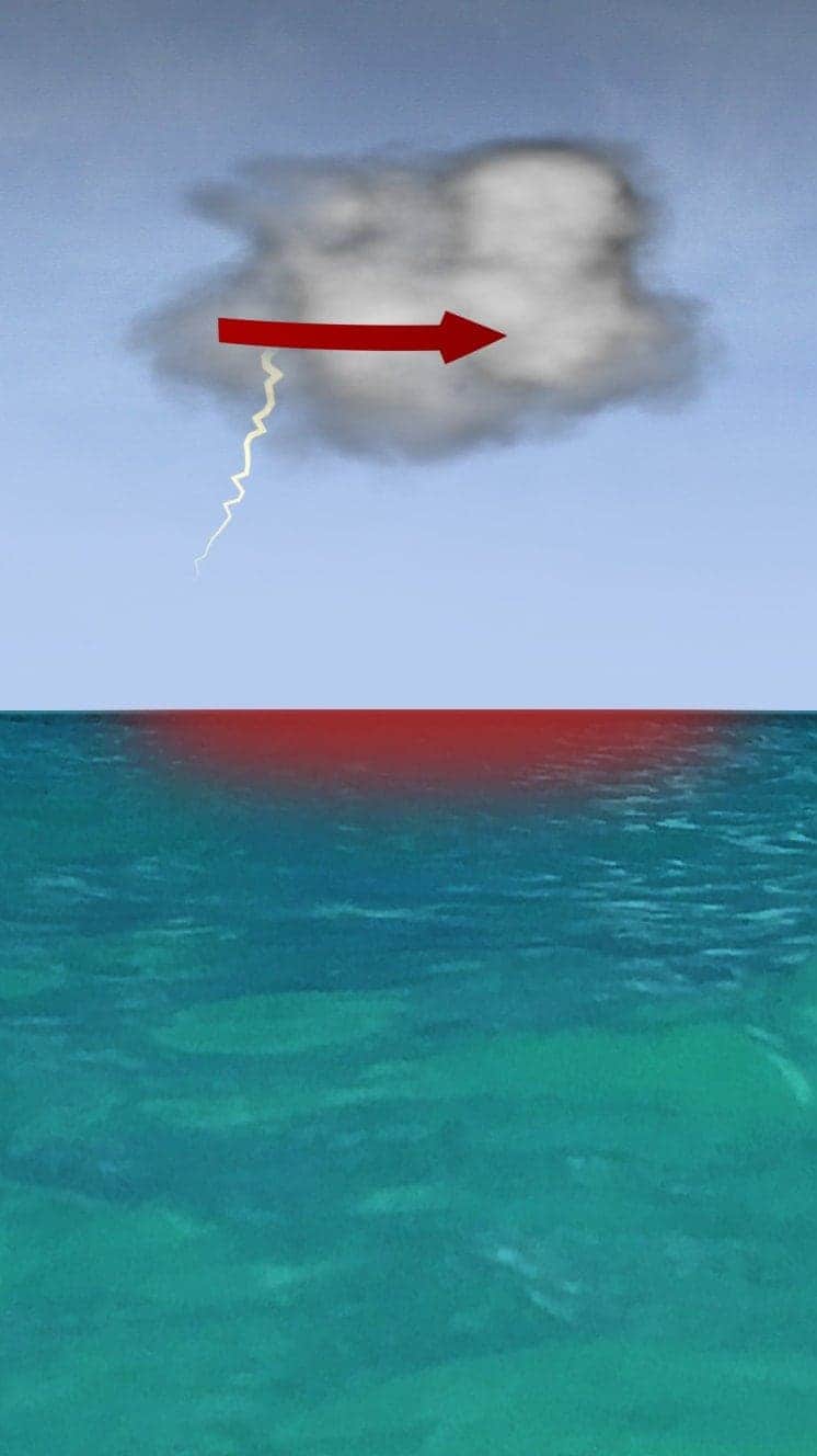
Hurricanes develop from thunderstorms, fuelled by warm, moist air as they cross sub-tropical waters.
Warm air rises into the storm.
Air swirls in to fill the low pressure in the storm, sucking air in and upwards, reinforcing the low pressure.
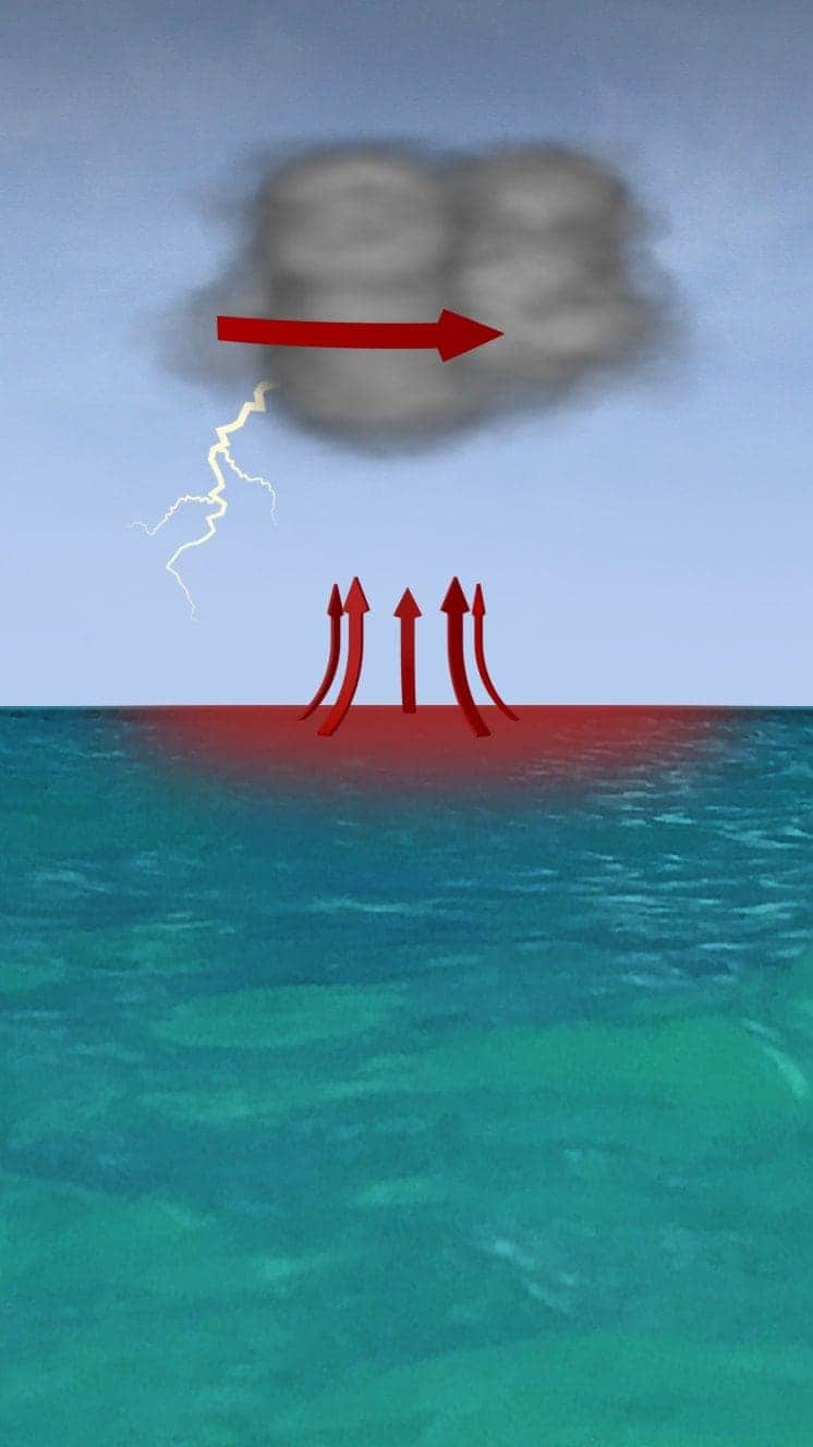
The storm rotates due to the spin of the earth and energy from the warm ocean increases wind speeds as it builds.
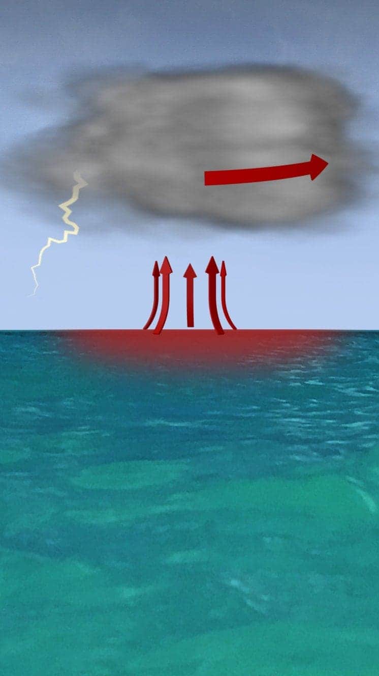
When winds reach 119km/h (74mph), it is known as a hurricane – in the Atlantic and Eastern Pacific – or a typhoon in the Western Pacific.

"Everybody has a plan until they get punched in the face. Well, we're about to get punched in the face."
Florida Mayor Bob Buckhorn, ahead of Hurricane Irma (2017)
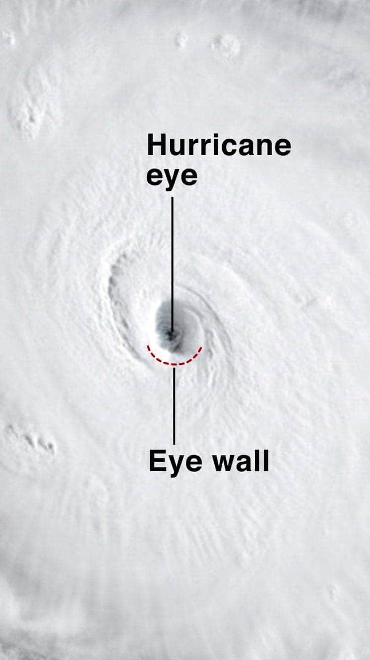
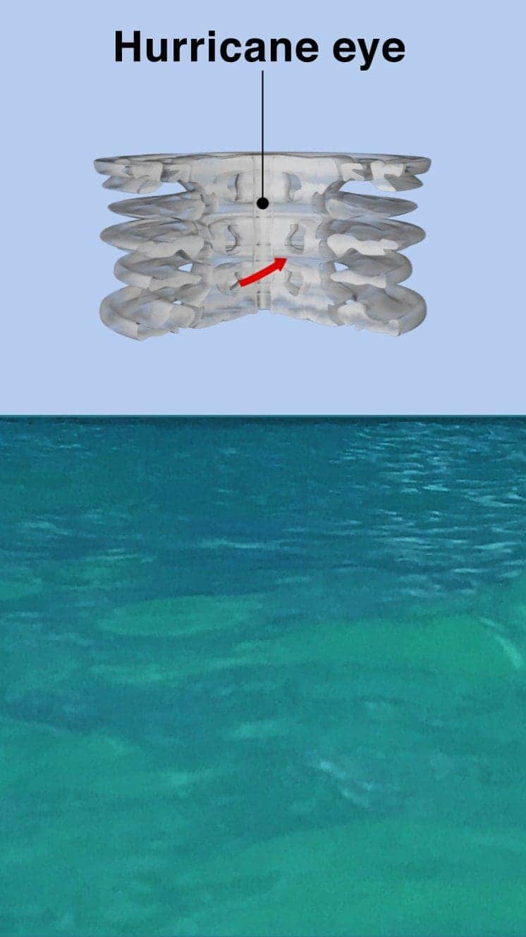
The central eye of calmer weather is surrounded by a wall of rainstorms.
This eyewall has the fastest winds below it and violent currents of air rising through it.
A mound of water piles up below the eye which is unleashed as the storm reaches land.
These storm surges can cause more damage from flooding than the winds.

"Urgent warning about the rapid rise of water on the SW FL coast with the passage of #Irma's eye. MOVE AWAY FROM THE WATER!"
Tweet from the National Hurricane Center
The size of hurricanes is mainly measured by the Saffir-Simpson scale – other scales are used in Asia Pacific and Australia.
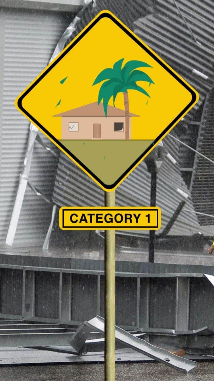
Winds 119-153km/h
Some minor flooding, little structural damage.
Storm surge +1.2m-1.5m>Read More – Source